
Orlando Weather Outlook: Dry and Pleasant Conditions Ahead
Following a week of intense rains and tropical moisture, Central Florida is currently under a more tranquil weather pattern.
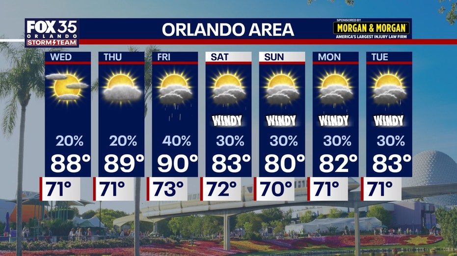
Following a week of intense rains and tropical moisture, Central Florida is currently under a more tranquil weather pattern. High pressure is expected to maintain dryness across most areas, offering a mix of sunshine and clouds along with a minimal chance of isolated showers. For Wednesday through Friday, afternoon temperatures in Orlando are forecasted to range from 88 to 90 degrees, while beach areas will see cooler conditions between 83 and 85 degrees.
As midweek approaches, rain probabilities are set to rise. Onshore winds are anticipated to bring back Atlantic moisture, leading to potential showers mainly southeast of I-4 on Wednesday. By Thursday, chances of rain will increase to 20-50%, particularly in areas near and south of Orlando, along with a slight risk for afternoon thunderstorms, though severe weather is not expected.
This weekend, a cold front will sweep through Central Florida from late Friday into Saturday, resulting in robust high pressure formation to the north. This shift will lead to strong northeast to east winds lasting into the early part of the following week, with gusts reaching 30-40 mph, especially near coastal regions. Offshore winds could hit 20-30 knots, creating hazardous conditions with seas climbing to 7-10 feet, and heightened risks of dangerous surf and rip currents through early next week. Temperatures will also cool slightly, with highs dropping into the low to mid 80s on Saturday and upper 70s to lower 80s on Sunday.
In terms of tropical activity, the Atlantic is relatively calm at this time, with no immediate threats to Central Florida noted in current forecasts. The weather issues expected this weekend are attributed to a frontal boundary and not linked to any tropical cyclone.



Comments
No comments yet.